Treaty Authority
Geospatial collaboration supporting a fair and just Treaty.


Designing and implementing geospatial technology to support the Treaty Authority’s role as the independent body overseeing Treaty-making in Victoria.
Providing strategic advice, design, and analysis services to deliver online mapping tools that support informed negotiation, improve cultural data visibility, and streamline engagement with Traditional Owners and stakeholders.
Challenge
The Treaty Authority is responsible for implementing tools and processes that support the Treaty Negotiation Framework, including managing and visualising geospatial data from Traditional Owners. Mapping solutions were designed to uphold Indigenous data sovereignty, self-determination, and cultural governance—ensuring First Nations voices are respected in a fair, inclusive process.
Solution
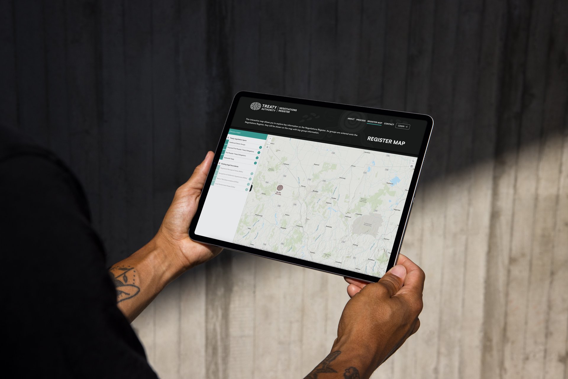
The Negotiations Register Map uses custom symbology to help the public explore key information about Treaty Negotiations. It is underpinned by geospatial processes designed to manage data throughout the negotiation journey and support appropriate sharing aligned with Traditional knowledge frameworks and Indigenous data sovereignty principles.
Impact
Clearly and visibly demonstrate the Country on which First Peoples intend to enter into Treaty Negotiations and on which Treaty Negotiations are underway and share visibility of cultural landscapes and stories relating to negotiation processes for Traditional Owners. The Geospatial Map aims to ensure transparency and provide information about the areas of Country covered and the Parties involved in Treaty Negotiations as they move through the negotiation process.